Exciting new content is on the horizon for The Biogeologist in 2018!

All the best for 2018! I look forward to creating exciting new content for The Biogeologist in the coming year. Fun fact: did you know that a single year represents only ~ 0.000,000,022 % of Earth’s history?

One of my plans for 2018 is to post new content on a more regular basis. I will continue to cover fascinating subjects from all aspects of the natural world, but a major focus for this year will be to create a set of articles on climate dynamics and climate change, and the common misconceptions associated with these themes. I also aim to include a section dedicated to wildlife- and landscape photography, where I will share some of my favorite shots from the past years.

You can follow the adventures of The Biogeologist on the web and on your favorite social media, including Facebook, Twitter and Instagram. You can also subscribe to receive notifications of all the new content by entering your e-mail address on the ‘Subscribe’ section in the right sidebar of the website. Finally, if you have any comments or suggestions, please get in touch!

Thank you for your continued support and I hope to welcome you back often in the future!

– Robin


Image: Walls of Antelope Canyon in the Colorado Plateau of Arizona, USA. Source: Luca Galuzzi, Wikimedia Commons.

Earth – A Tale of Spheres

Seen from space, Earth can be divided into a series of layers or zones that are referred to as spheres. The outermost of these layers is the magnetosphere, which is the region around Earth that is affected by its magnetic field. This field originates from a dynamo deep inside the planet and is mostly a dipole, characterized by a North Pole and a South Pole. Importantly, Earth’s magnetic field acts as a shield against the charged particles of the solar wind and the cosmic rays from supernova explosions. Still, some of these particles make it past the shield and are focused to the polar regions along magnetic field lines. When these particles interact with gas atoms in the upper atmosphere, they can result in spectacular phenomena such as aurorae.

The atmosphere is the envelope of gas that surrounds the Earth. It consists of ~ 78 % nitrogen (N2), ~ 21 % oxygen (O2) and a number of different traces gases, such as ozone (O3), carbon dioxide (CO2), methane (CH4) and water vapor (H2O). This mixture of gases is more commonly known as air. Both the air density and the air pressure gradually decrease with altitude and as a result, almost all gas molecules are found in the lowermost 50 km of the atmosphere. The air pressure is ~ 1 bar at Earth’s surface, but less than ~ 0.01 bar at an altitude of 30 km.

Approximately 30 % of Earth’s surface consists of continents and islands, while as much as 70 % is covered with water. The total mass of water on Earth, in the form of oceans, glaciers, lakes, rivers, groundwater and the atmosphere, is known as the hydrosphere. Notably, less than 3 % of all water on the planet is fresh water, and most of this fresh water is stored in glaciers and groundwater. The ice-covered regions of Earth’s surface are also known as the cryosphere.

The solid surface and interior of the Earth are referred to as the geosphere. Earth’s surface displays dramatic changes in topography that are related to a variety of processes, but unlike the surfaces of the Moon and Mars, it features relatively few meteorite impact craters. Both the continents and the ocean floor are characterized by steep mountains, extensive plains and deep valleys. The highest mountain above sea level is Mount Everest and the deepest part of the oceans is located in the Mariana Trench.

Perhaps the most striking feature of Earth is its ability to sustain life. Living organisms occur in many magnificent forms across a wide range of habitats and ecosystems, from barren deserts to lush rainforests. All life on Earth together constitutes the biosphere.

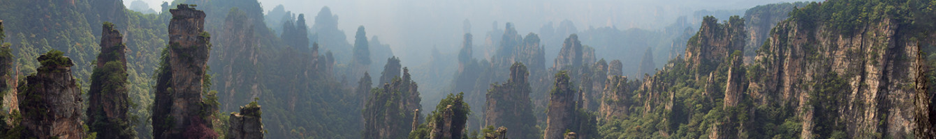
The boundaries between these so-called spheres are not always apparent, because the spheres interact in many ways. For example, the atmosphere plays a major role in the hydrological cycle, the exchange of water among the various reservoirs of the hydrosphere. In addition, some of the most impressive natural phenomena are related to the interplay between elements of the biosphere and the geosphere.


Book reference: Marshak, S. (2007). Earth: Portrait of a Planet: Third International Student Edition. WW Norton & Company.

Image: Earth as seen from space, also known as the Blue Marble. Credit: NASA/NOAA/Reto Stöckli.

Seven Earth-like exoplanets discovered orbiting a single nearby star

Astronomers at the University of Liège in Belgium have discovered seven Earth-like exoplanets orbiting a single, nearby star called TRAPPIST-1. The scientists have uncovered these planets with NASA’s Spitzer Space Telescope and several ground-based telescopes, by detecting small decreases in the light intensity of the star as the planets passed in front of it. TRAPPIST-1 is located approximately 40 lightyears from the Earth in the constellation Aquarius and is so small and cool that all seven planets feature temperate conditions, suggesting that liquid water could be present at any of their surfaces. Moreover, three of these planets are located within the habitable zone, the area around a star where conditions are most favorable for life. This discovery, which has been published in Nature, represents a new record for the greatest number of habitable-zone planets found in a single star system and is therefore an important milestone in the search for extraterrestrial life.

For more on the story behind this fascinating discovery, watch the video by NASA below.


Journal reference: Gillon, M. et al. (2017). Seven temperate terrestrial planets around the nearby ultracool dwarf star TRAPPIST-1. Nature, 542(7642), 456–460.

Image: Artist’s impression of the surface of TRAPPIST-1f, one of the newly discovered planets in the TRAPPIST-1 star system. Credit: NASA/JPL-Caltech.

Meteorite reveals two billion year history of volcanism on Mars

Scientists from the University of Houston have discovered that volcanism on Mars occurred over a period of at least two billion years, much longer than previously thought. Their findings are based on geochemical analyses of a Martian meteorite found in northwest Africa and have been published in Science Advances. The meteorite, a type of igneous rock known as shergottite, was found to have an age of approximately 2.4 billion years and is similar in composition and origin to a group of ten other Martian meteorites with ages of 327 to 574 million years. These rocks were likely ejected into space towards the Earth during a single impact 1.1 million years ago, which further suggests that they were all derived from the same volcanic source. Therefore, the spatial and temporal relationships of these meteorites indicate that volcanism must have occurred for over two billion years at the same location. This amazing discovery sheds new light on the formation of the planet and suggests that Mars was to some of the longest-lived volcanoes in the Solar System.


Journal reference: Lapen, T. J., Righter, M., Andreasen, R., Irving, A. J., Satkoski, A. M., Beard, B. L., Nishiizumi, K., Jull, A. J. T. & Caffee, M. W. (2017). Two billion years of magmatism recorded from a single Mars meteorite ejection site. Science Advances, 3(2).

Image: Olympus Mons, the largest volcano on Mars, as seen from the Viking 1 Orbiter. Credit: NASA.

Giant’s Causeway, County Antrim, Northern Ireland

The Giant’s Causeway is an area along the coast of Northern Ireland where up to 40 thousand pillars of black basalt rise up from the sea. These basalts formed as a result of intense volcanic activity during the Paleocene, approximately 50 – 60 million years ago. The pillars obtained their characteristic, mostly hexagonal shape through contraction and horizontal fracturing after cooling of the lava plateau. According to legends, giants walked over these rocks to cross the sea.

Click here to view the whereabouts of the Giant’s Causeway and other amazing locations on our Explorer’s World Map!


Information source: UNESCO World Heritage Convention

Image: Basalt pillars of the Giant’s Causeway in County Antrim, Northern Ireland. Credit: Jal74, Wikimedia Commons.

Pamukkale, Denizli Province, Turkey

Pamukkale is a geological site in the Denizli Province in southwest Turkey that is famous for its hot water springs and cascade of travertine terraces. The surreal, crystal-white structures of the site are formed by the rapid precipitation of calcium carbonate minerals from the supersaturated waters of the geothermal springs. As these mineral-rich waters reach the surface, dissolved carbon dioxide (CO2) degasses, increasing the pH of the water and eventually resulting in the formation of spectacular travertine deposits. In Turkish, the name Pamukkale means “Cotton Palace”.

Click here to view the whereabouts of Pamukkale and other amazing locations on our Explorer’s World Map!


Information source: UNESCO World Heritage Convention.

Image: Pools and travertine terraces of Pamukkale in Turkey. Credit: Antoine Taveneaux, Wikimedia Commons.